Satellite Data Acquisition
Satellite Data Acquisition
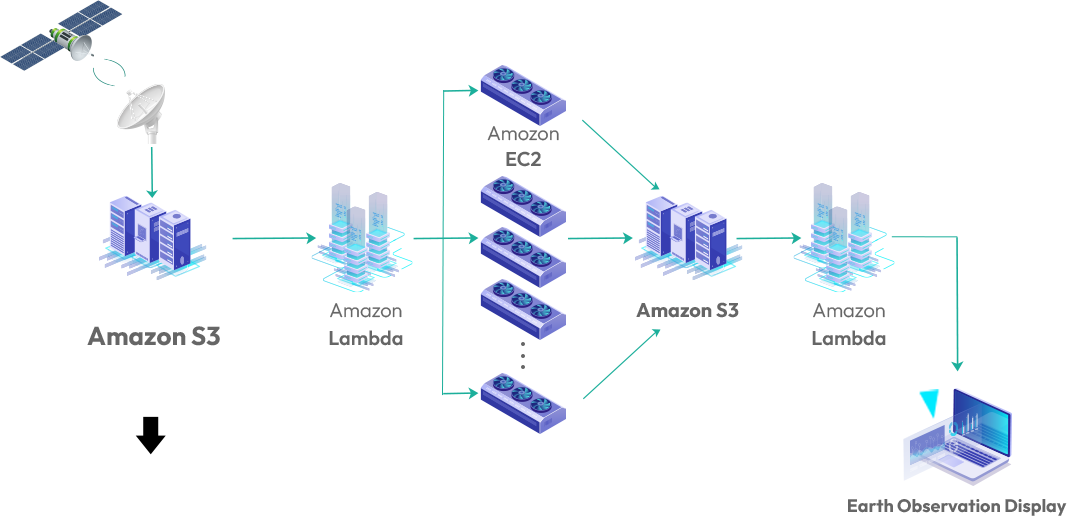
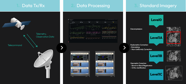
The satellite data acquisition team sequentially performs transmission and reception of satellite data, processing the data, and producing standard satellite images.
view moreIn-situ Data Analysis

In-situ Data Analysis
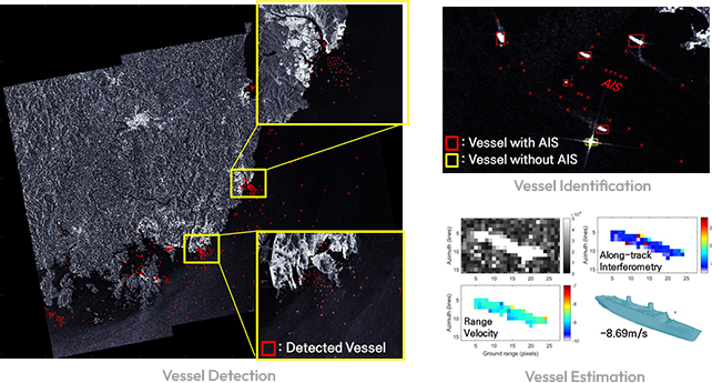
The in-situ data analysis team utilizes in-situ observation equipment (for example AIS, Automobile SAR, research cruises) to produce data for understanding satellite observations.
view moreNumerical Modeling
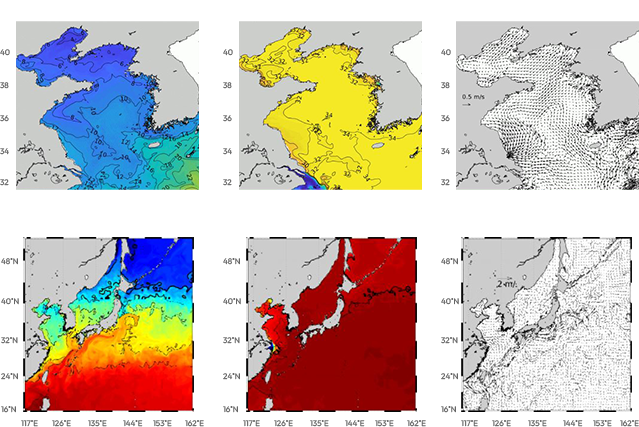
Numerical Modeling
The numerical modeling team simulates and predicts the physical state (temperature, salinity, density, atmospheric conditions) of the Earth over time and space.
view moreData Processing and Application
Data Processing and Application
The data processing and application team advances state-of-the-art technology and applies analysis results for disaster monitoring, environmental change detection, and safety inspection.
view more