


In-situ Data Analysis
AIS (Automated Identification System)
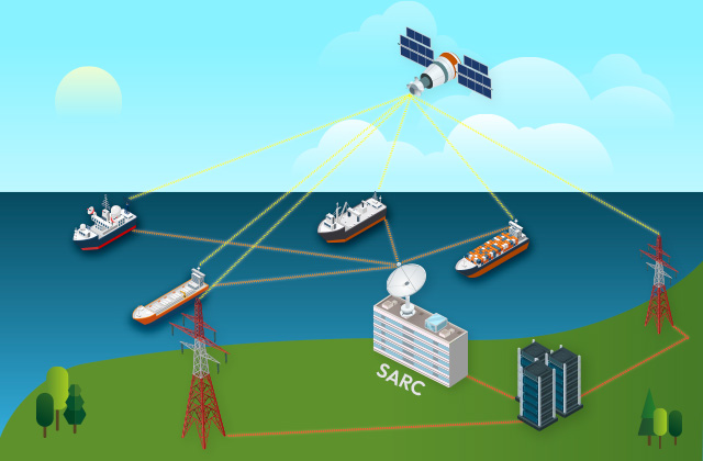
AIS (Automated Identification System)
Containing the real-time position and velocity of vessels, AIS information was often utilized as a reliable source of vessel surveillance. Applying the joint utilization of AIS information and vessel detection outputs using a CNN-based object detector, SARC is pursuing a data fusion between real-time AIS information and vessels in SAR image data for robust vessel detection and identification. Accompanied with a real-time AIS receiver, SARC is able to perform a fast and accurate surveillance of vessels in waters adjacent to the Korean peninsula.
IORS (Ieodo Ocean Research Station)
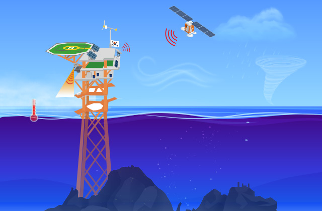
IORS (Ieodo Ocean Research Station)
Along with the IORS, a number of research stations near the Korean peninsula provide a site of in-situ data measurement for remote sensing applications. Accessing multi-parameter information from the observation stations, SARC implements the acquired data to (i) predict marine conditions exploiting the physical oceanographic parameters and (ii) calibrate remotely sensed data by generating reliable observation data.
Airborne SAR and Automobile SAR

Airborne SAR and automobile SAR
Prior to launching a SAR satellite, the SAR system testing is necessary through ground field experiments. Airborne SAR provides a flight environment similar to satellite SAR that can manage through the ground experiment. Automobile SAR has the benefits of convenience and low cost. SARC tests the prototypes for the next generation of satellite SAR payloads on-ground field experiments. In addition, SARC conducts useful missions independently with airborne, automobile SAR by utilizing the distinct properties compared to satellite SAR.
ESROB
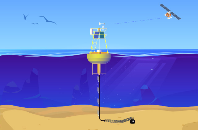
ESROB
A surface mooring named the East Sea Real-time Ocean Buoy (ESROB) has been operated and used as an in-situ and real-time ocean observing platform since 1999 off the mid-east coast of Korea. The ESROB is located 9 km off the coast in a water depth of 130 m providing meteorological and oceanographic (physical and biogeochemical) data every 10 minutes from oceanographic instruments. The in-situ data collected from 1999 to 2016 are quality controlled and quality assured via typical data processing methods, and provided via SEANOE (https://doi.org/10.17882/57744). The data have been used to address various ocean processes.
EC1
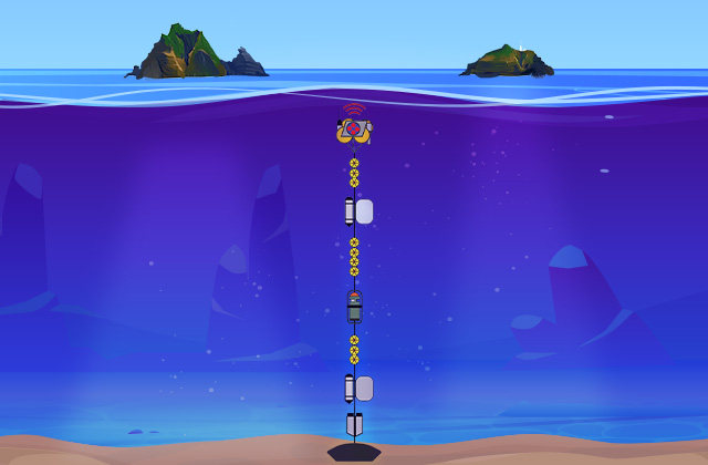
EC1
A subsurface mooring named the East Sea Current-meter 1 (EC1), located in a water depth of 2,300 m in the middle of the Ulleung Interplain Gap (UIG) between Dokdo and Ulleung Island in the southwestern East Sea (Japan Sea), has been operated since 1996.
The EC1 is now a part of the global ocean observing system through the OceanSITES (http://www.oceansites.org). The mooring was initially deployed in 1996 to quantify the temporal variability of deep flows, as the UIG is the only deep channel between the Ulleung Basin and Japan Basin. Since then, long and continuous time-series data have been collected to observe the temporal variability of essential ocean variables consistently. The data collected from 1996 to 2020 were corrected to improve their quality and scientific applicability, published via SEANOE (https://doi.org/10.17882/78916), and analyzed to address a wide range of ocean processes
Research cruises
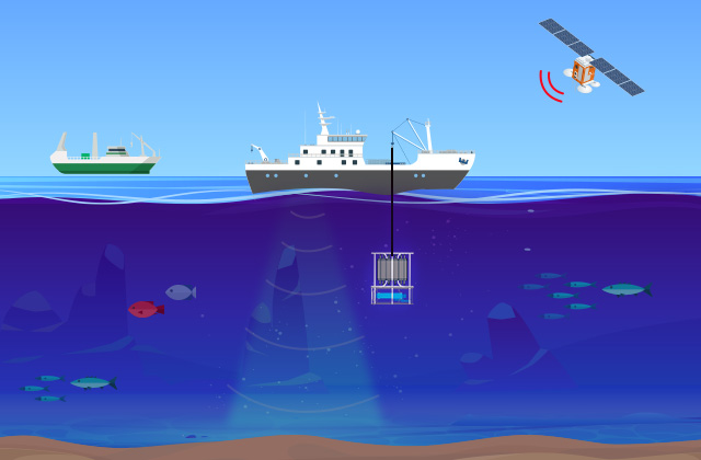
Research cruises
Precise in-situ data have been collected via research cruises. Several Korean governmental and private research vessels have been utilized for such cruises in a routine basis, e.g., multiple times per year. From 2015 to 2021, a total of 38 research cruises were conducted to collect in-situ data in the seas around the Korean Peninsula and open/far ocean/sea. The in-situ data collected from various types of research cruises are analyzed to address a wide range of ocean processes.

