


EO Pipeline Design and Integration
Various optical/non-optical satellite data and in-situ data are directly acquired by the center, and integrated to produce usable information. To leverage such data for scientific and practical purposes, the data integration team links, matches, and compares such data for further processing and analysis as part of complete processing chains. To develop such processing chains, linking algorithms are also developed by the members of the section to present analytic or monitoring systems that are being operated for various applications such as disaster monitoring, environmental change monitoring, and safety inspection.
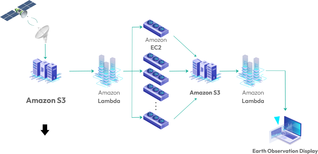
For the system, satellite data are regularly downloaded and added to storages in the cloud (e.g., AWS: Amazon Web Services), which have already been converted to cloud-optimized image formats for cloud-based image processing, and then the data is integrated with acquired in-situ data. When the received satellite data is saved in Amazon Simple Storage Service (Amazon S3), event-based Lambda is automatically triggered to run a corresponding module for analysis, by which the satellite data is analyzed for specific purposes. The required analytic modules are installed in the cloud server and started to run automatically by Lambda for integrated data processing. All of the necessary algorithms for connecting analytic and monitoring procedures are developed and programmed by our team members to automatically trigger sequential processing steps in the platform.
